Contaminated armories

Inspectors had found lead in hundreds of United States armories with firing ranges between 2012 and 2016, and hundreds more had not been inspected at all, despite The National Guard ordering states to conduct such inspections. Nearly 200 armories' inspections reported lead outside of the firing ranges themselves, including to public areas where children visited.

December 2016

A gray and white map of the United States with red, green, and gray dots that encode where armories are located and whether lead was found there (red if so, green if not, and gray if the data is available).

Contributions

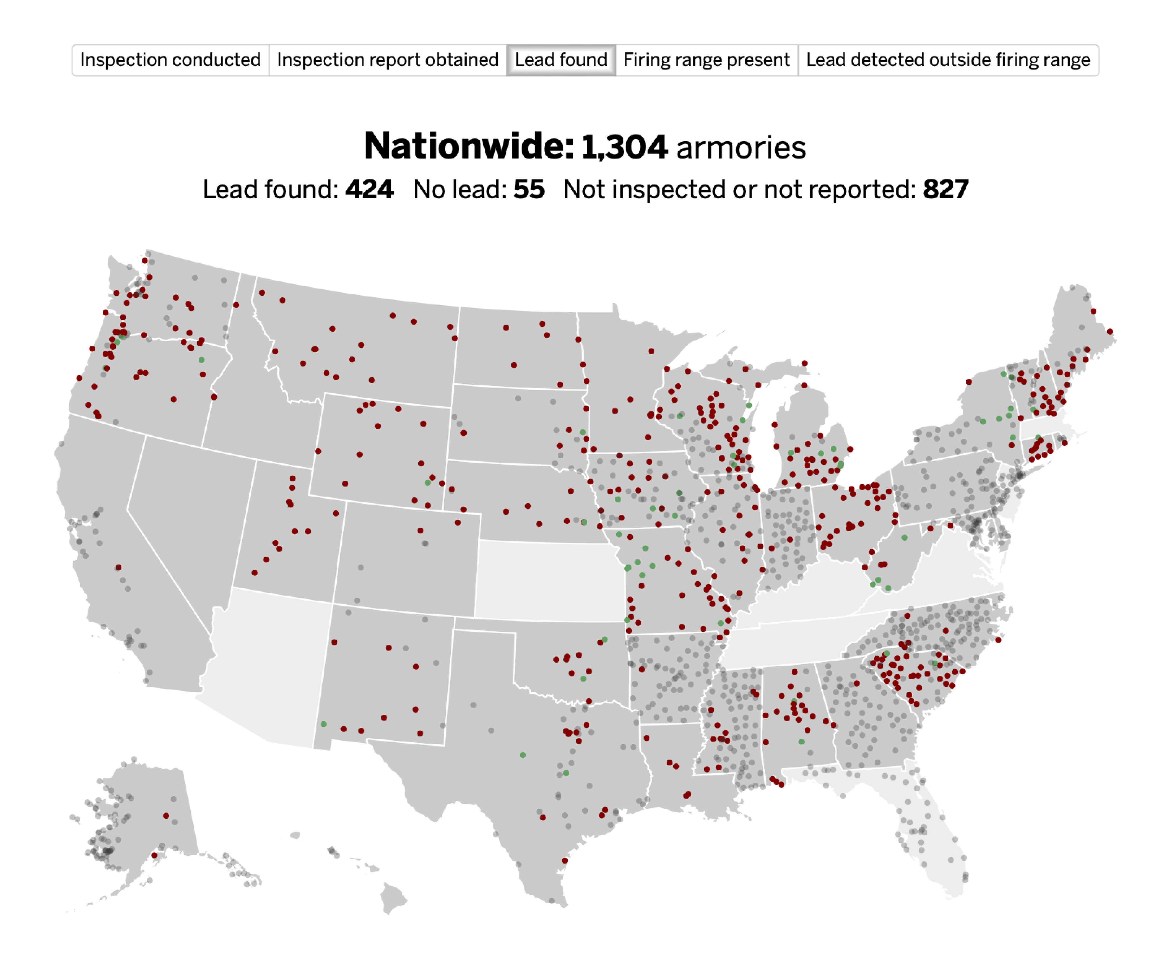
I helped build the database underlying the investigation and an interactive map by automating the digitization of more than 23,000 pages of public records from 41 states. I used a combination of flatbed scanners’ email options and the Gmail API to add metadata to the documents, then used the DocumentCloud API to upload these scans for public review, all of which are linked to directly from the interactive map.

I designed the interactive map with Adobe Illustrator and Tableau Desktop.